 |
St. Marys History
In 1767, plans were made to establish a town at an area known as Buttermilk Bluff on the southeastern tip of Georgia. On November 20, 1787, the twenty founders of St. Marys gathered on Cumberland Island to sign the "Articles of Agreement." It wasn't until 1788 that this area was surveyed and the city lots laid out.
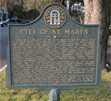
Text from Georgia Historical Commission marker (of 1954): This town was built on the north bank of the St. Marys River at a placed called Buttermilk Bluff. Original tract of land containing 1620 acres was purchased by the proprietors for laying out the Town of St. Marys from Jacob Weed for thirty-eight dollars on Dec. 12, 1787. City first laid out by James Finley, County Surveyor, Aug. 1788 and recorded Jan. 5, 1789. The twenty proprietors of the town were: Isaac Wheeler, William Norris, Nathaniel Ashley, William Ashley, Lodowick Ashley, James Seagrove, James Finley, John Fleming, Robert Seagrove, Thomas Norris, Henry Osborne, Thomas Norris, Jacob Weed, John Alexander, Langley Bryant, Jonathan Bartlett, Stephen Conyers, William Reddy, Prentis Gallup , Simeon Dillingham, and Richard Cole. City laid out second time as authorized by an Act of Dec. 5, 1792. Map of town drawn by Parker, Hopkins, and Meers, certified by James Parker, County Surveyor, Jan. 3, 1792. Town of St. Marys was incorporated by an Act passed Nov. 11, 1802. St. Marys temporary county seat until first courthouse and Gaol erected at Jefferson
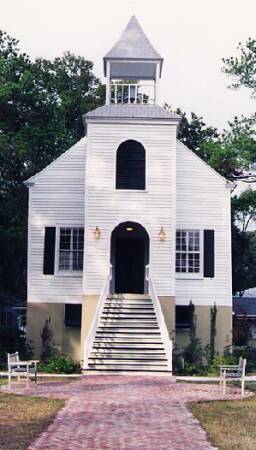
(Jeffersonton) as authorized and named in Act passed Nov. 29, 1900. Jeffersonton was permanent county seat for sixty-nine years (1801-1871). Election held Jan. 3, 1871 authorized by Act passed Oct. 27, 1870 for removal of county seat from Jeffersonton to St. Marys. St. Marys permanent county seat for fifty-two years (1871-1923). Act of Aug. 11, 1923 authorized removal of county seat from St. Marys to Woodbine. [END Georgia Historical Commission Marker - 1954.] St. Marys First Presbyterian Church The streets of old St. Marys are named for these men. All received lots in St. Marys, but most did not settle here. Many sold their lots either to others in the original group of 20 or to outsiders. One of the most colorful of the lot was Henry Osborne. The main street that runs through old St. Marys is named for him. He was eventually made a judge but was later impeached for voting fraud. However, some sources claim the main reason he was impeached was for bigamy. He was never brought to trial as he did not oppose his suspension. In 1792, St. Marys was established as a town by an act of the Georgia Legislature. However, it wasn't until November of 1802 that St. Marys was actually incorporated. Some claims are made that St. Marys is the second oldest US city. I haven't seen the proof for this claim. In fact, there are many New England town and cities with incorporation dates set before St. Marys'. So let's put this myth to rest! Washington Pump and Oak Marker
On the day that the Father of His Country was buried at Mt. Vernon, local services were also held throughout the nation. St. Marys citizens marched to the dock to meet a boat bearing a flag draped casket, bore it up Osborn St. and with due ceremony and firing of guns, buried it where the Well known as the "Washington Pump" now is. To mark the spot four oaks were planted and have since been known as the "Washington Oaks". Only this one remains. This well was driven the year of Washington's burial and has ever since been called the "Washington Pump." Note: The oak tree was cut down some years ago. Slowly, St. Marys was settled. Being the southern-most US city - and close to both Indian and Spanish trade centers - St. Marys became an established port city. Rice, cotton, and long-staple cotton were all grown on plantations within the county. Rice was the most common as this area was made up of much tidal land - which was good for growing rice. Unfortunately, the ills of being a port are part of her history. Accounts have been written of ladies with questionable morals (and of slave women doing whatever was necessary to earn the money to free themselves), hard-drinking men, citizens who were either unfamiliar with the church or who simply refused to attend, and smugglers who were known for taking advantage of the small port. Of course, not all citizens fell into one of these categories. St. Marys' history is rich with mention of honorable residents. Eventually, St. Marys sordid past was laid to rest as its popularity as a port declined. While the occasional scandal still rears its ugly head - these are relatively few and far between. Photo taken from Lang's Dock 2001. Life continued on in a normal fashion for many years until the Revolutionary War broke out. Camden County, also referred to as the "Neutral Zone," was considered of military importance to the British due to its location. The Spanish were a short distance to the south in East Florida, the British were in West Florida and to the north, and the Indians resided to the west. When Georgia finally joined in the revolution, many Camden County residents fled to safer areas. Some residents never returned. It was not uncommon for plantation owners to feel loyalty towards the British. After all, the British helped them establish their own little "dukedoms" in the New World. The British were also their main customers. An American fort of this time was Fort McIntosh on the Satilla River. Located today near Atkinson in Brantley County, it was once part of Camden. Fort Wright, located near Scrubby Bluff on the St. Marys River, was a loyalist stronghold. While the British eventually captured Fort McIntosh, the Americans were unable to capture Fort Wright. Soldiers of the Revolution (Camden's Challenge): William Ashley, John Atkinson, Nathan Atkinson, John Bachlott, Abraham Bessent, John Brown, Jacob Clark, Charles Floyd, John Hardee, Elihu Hibbard, John Howell, Absalom Jackson, Charles Jackson, John King, William Niblack, John Owens, John Pearce, Richard Roberts, Thomas Rudulph, William Scott, James Seagrove, John Sheffie(l)d, West Sheffield, James Sleigh, Theophilus Weeks, Lewis S. Wilford.
During 1793 - 1805, Point Peter was of great military importance and almost $16,000 was spent on fortifying it. In 1806, a military directive ordered the shut down of the fortifications. Finally, in 1809, plans were made for a battery and a strong blockhouse at Pt. Peter. In 1812, there were 800 reserves stationed there, but unfortunately, most were moved before the War of 1812 broke out. In 1812, Camden County inhabitants sent a letter to the Governor (Peter Early) appealing for help to re-fortify Point Peter. Before aid could arrive, the English arrived. Point Peter only had 36 men to defend it. The British sailed into Cumberland Sound with a fleet of 2 ships, 7 frigates, 7 smaller armed vessels and 19 barges loaded with naval men: 1500 British Colonel and Negro troops aboard. They invaded Cumberland Island (landing and occupying both Plum Orchard and Dungeness) 2 days later. On January 13, 1815, they attacked Point Peter. After 14 casualties at Point Peter, the Americans withdrew and abandoned the fort. The British burned all the barracks of Point Peter and towed away all vessels at St. Marys. They occupied the town for about 1 week.
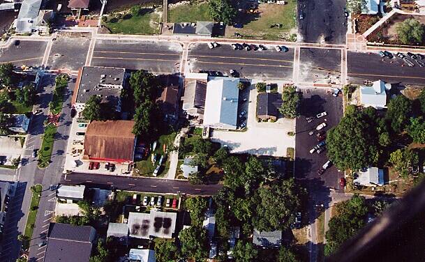
Aerial Photo of downtown St. Marys. Taken by James V. Fields June 17, 2001 ©. The British, in order to find the hiding place of the customs collection (a sizable amount) headed up the St. Marys River with 250 men aboard 6 barges. They planned on landing in present-day Charlton County at Camp Pinckney, then march to Spanish Creek, and eventually burn down Clark's Sawmill. What they did not know was that 30 riflemen were concealed along the banks of the river. The Americans opened fire, the British retreated, and the American riflemen followed them until 2/3 of the British were killed or wounded. Only 1 American was wounded. The invading Englishmen vowed to retaliate by burning every building between the St. Marys and Altamaha Rivers, but orders were finally received for a cease-fire. The peace treaty between America and Britain had been signed - just in time. Foggy Waterfront 2001.
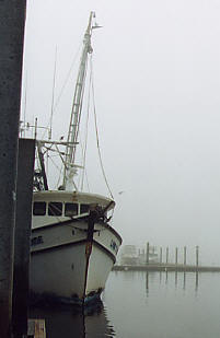
Shrimp Boat at Waterfront Dock 2001. Originally, St. Marys was the county seat. However, in November of 1800, Georgia Legislature established Jeffersonton as the county seat because of its central location. Most wealthy plantation owners resided in the middle and northern section of the county. The trip to St. Marys could take hours riding horse drawn buggies on rough dirt roads. In 1802, a courthouse and jail were established in Jeffersonton. Because of the prevalence of mosquitoes around Jeffersonton, many people died of malaria. Of course, during this time the cause of this disease wasn't known. Eventually, with the decline of the plantations, many people moved from the area of Jeffersonton. The area became a virtual ghost town. In addition to the negative aspects of mosquito-born diseases around the plantations, St. Marys was quickly growing as a popular port city. There was money to be made down at the waterfront! In 1872, the county decided to move the county seat back to St. Marys. Several years later a jail and courthouse were built in St. Marys. (In 1923 the county seat was again moved, this time to Woodbine. In 1928, the present courthouse was built. Woodbine remains the county seat today.) Angel Grave Marker at St. Marys Oak Grove Cemetery. Among the earliest settlers of St. Marys were the French-speaking Acadians. They came to America after being first driven from Acadia (originally in Nova Scotia) by the English and then from the island-country of St. Domingo. Early Acadian graves can be easily spotted in the Oak Grove Cemetery in St. Marys by the French writing on their headstones. In 1801, then again in 1808, yellow fever hit St. Marys with disastrous results. The 1808 epidemic left 84 people dead out of only about 300 citizens. Some of their graves are located in Oak Grove Cemetery in St. Marys. Because of this reoccurring epidemic, a Health Officer was appointed. In 1881, quarantine grounds were set up on Sapelo Island. All ships with infected people were sent there until the Health Officer deemed it safe to release them. In the early days, the cause of these epidemics was unknown. Clothing and possessions of infected people were burned as a preventative. It wasn't until much later that it was learned that Yellow Fever was a mosquito born illness that was spread through body fluids. A partial list of victims can be found on the yellow fever page. During this period, visitors to St. Marys described it as a bustling port city - but with few amusements. The days tended to be warm and uncomfortable (welcome to the South!) and one man said something about "being visited by 10,000 million sand flies." Well, some things NEVER change! Orange Hall
The years after the War of 1812 were hard, but remarks from 1837 stated that the town was flourishing and that food was plentiful. In 1854, and once again in 1859, St. Marys was hit again by yellow fever. Taken directly from "Camden's Challenge" is the following tale of John Coglan "...who was nursed during his illness of yellow fever by his finance, Louisa Proctor. When they both died of the disease, her brother had them buried side by side (in the Oak Grove Cemetery in St. Marys) and the gravestones inscribed simply "My Friend" and "My Sister." Their stones can be seen today. Yellow Fever was a very unpleasant disease. It damaged the internal organs and could cause massive bleeding - the main cause of death. During the Civil War, many locals went to fight for the Confederacy. Many are buried throughout the county. While St. Marys
was spared, Federal Troops captured nearby Fernandina. Raiding parties went
out looting, plundering and burning. Nevertheless, citizens and their homes
survived the war. The remaining citizens again picked up the pieces of their
lives and by the 1870s appeared to be a prospering little town. I will not
go into details of the Civil War more. The local history books have
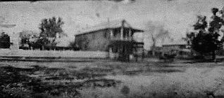
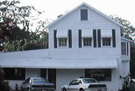
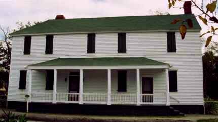
One of the oldest homes in St. Marys is the Jackson, Bessent, Clark, MacDonnell house (right). Now, obviously I cannot go into EVERY business, but I will write about some. If you know of one of special interest that should belong here leave me a note with the details and I will include it. NOTE: This page is not for advertising, so please do not ask me to write about your business unless it has historical interest. Riverview Hotel. The Riverview Hotel, still located on the St. Marys Waterfront, was built in 1916. It was a
thriving business but closed after many years. In the 1970s it was renovated and reopened and today is open for business. It consists of 20 rooms, 8 baths, a lobby, and a
Many successful businesses have come and gone, but Gilman Paper Company brought on the largest growth of the town to its date. It began operation in 1941 and continues today. Currently it is under some strain and there are doubts about its future here. The Navy came into Kings Bay in the 1970s and brought on another large growth period that continues today. This growth has affected the entire county. If you would like to know more about Kings Bay, please visit The Official Kings Bay Naval Submarine Base Home Page. Sterling's Grocery. Date? One local business that I just *have* to mention is Sterling's grocery. It is the longest running grocery stores around and one of the first businesses. Originally located on the east side of Osborne Street, it was later moved to its present west side location in 1896. Mr. David and Elizabeth Sterling started it and it remained in the family until 1998-1999. They died in the 1950s and their son, Mr. Thomas David Sterling, who was born in 1908 in St. Marys, ran it most recently. The store is located on the right side of Osborne Street when heading towards the St. Marys
Sterling's Grocery - ca late 1990s Waterfront 1 or 2 blocks past Orange Hall. It is a large white building sitting on the corner with the name STERLING written in large letters on the side of the building. Mr. Sterling passed away and his business has passed on to other hands and no longer sells groceries. For many years, the main mode of transportation was the St. Marys River Ferry. The St. Marys to Kingsland Trolley can be seen in a small, white building sitting next to the St. Marys City Hall Office Complex on Osborne Street. It was designed before 1911. For a time, this was one of the only means of travel between the two towns. In 1997, an article was published in the FL/GA Times Union about a the journal of a St. Marys woman, Maria O. Bessent-Burns. They have given me permission to reprint the article on my web site. In the April 1996 issue of Money Magazine, St. Marys was named the #1 Small Boomtown.
|
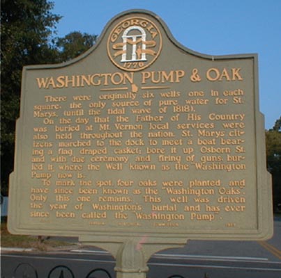 Text Reads: There were originally six wells, one in each square, (the only source of fresh
water for St. Marys, until the tidal wave of 1818).
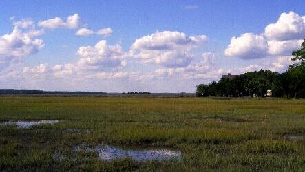
 Photo taken from Lang's Dock 2001.
 With the British gone, life began to return to normal. Camden County again prospered. The lush land called back many of those who left, and brought in many new people. The skirmishes along the GA/FL border finally ceased in 1821 when Spain ceded FL to the US. Well, it has not totally ended; anyone who's ever been to a GA/FL football game will see that!
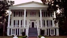 However, what was also mentioned was a lack of certain foods. At times there seemed to be little fresh meat, milk, butter, corn, or potatoes. This was remarkable considering the richness of the land. Houses tended to be functional but drab. An exception to this would be Orange Hall - a fine example of the Greek Revival style. It does seem to be agreed upon
that the residents were, for the most part, respectable & good people. However, mention has been made that this area was known for its courser entertainment.
  covered
the subject far better than I can hope to.
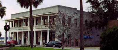 dining room on the ground floor with additional space for stores. Today, besides being a hotel, it houses Seagle's Restaurant... one of the finest restaurants in the area! Rumor has it that a ghost may have taken up permanent residence there…